Groundwater salinity distribution mapping for Ca Mau province
- Version
- Download
- File Size 15.95 MB
- File Count 1
- Create Date Friday May 28th, 2021
- Last Updated 02.06.2026
Technical Note TN-IV-03
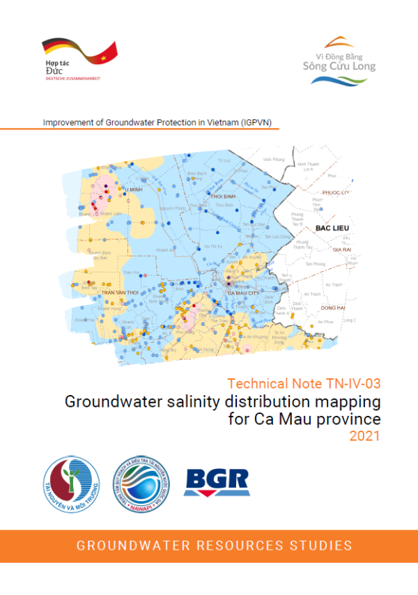
Groundwater salinity distribution mapping for Ca Mau province
2021
In Ca Mau Province, groundwater (GW) is the principal supply source for domestic, industrial, agricultural and aquaculture uses, as surface water sources are often saline. Knowledge about the GW salinity distribution is hence essential for individual GW users and authorities during the licensing process. Groundwater salinity is also one important criteria for the delineation of the restrictions on groundwater exploitation (Decree 167/2018/ND-CP). The purpose of the salinity maps are to improve data density and hence resolution of salinity maps by
integrating salinity data obtained from a number of sources including the IGPVN well survey to support decision-making.
A total of 1593 EC and/or TDS results from 11 different sources (NAWAPI, IGPVN, VIWAT) during the years 2010-2021 were compiled for Ca Mau province. The corresponding aquifer was assigned based on the well depth and the 3D hydrostratigraphic model from IGPVN. EC values were converted to TDS based on a non-linear equation derived from a data subset. Declustering and elimination of outliers were performed manually based on semi-variograms. Interpolation was performed with ordinary kriging and salinity maps produced for five aquifers with sufficient data coverage (qp3, qp2-3 , qp1, n22, n21).
This Technical Note TN-IV-03 contains five salinity maps for the aquifers qp3, qp2-3, qp1, n22, and n21 for Ca Mau province (GIS format), two intersection maps for qp2-3, qp1, n22 for 1 and 1.5 g/L TDS, as well as a detailed comparison to previously existing salinity maps. It also looks into some of the natural and anthropogenic factors of salinity.
Attached Files
| File | Action |
|---|---|
| TN-IV-03 Salinity map CaMau_EN_comp.pdf | Download |