

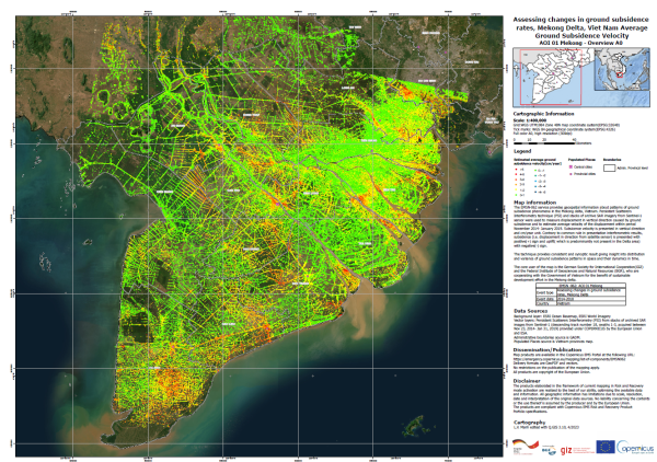
(English) Map: Assessing changes in ground subsidence rates, Mekong Delta, Vietnam
- Version
- Download 2
- File Size 10.44 MB
- File Count 1
- Create Date 20/04/2023
- Last Updated 12.06.2026
This map was produced by BGR and GIZ using the expanded EMSN-062 dataset "Assessing changes in ground subsidence rates,Mekong Delta, Vietnam" under the EU COPERNICUS "EMERGENCY MANAGEMENT SERVICE - RISK AND RECOVERY MAPPING" program in 2019. It includes some additional data points from the original processing located beyond the initial area of interest for the EMSN-062 activation.
The official dataset and report can be found under:
https://mapping.emergency.copernicus.eu/activations/EMSN062/
Attached Files
| File | Action |
|---|---|
| 20.4.2023 Subsidence map in MKD_satellite imagery_final.pdf | Download |